Navigation
Table of contents
- 2. REPORTING AT SURFACE WATER BODY LEVEL (SCHEMA SWB)
- 2.3. Pressures and impacts on surface waters
- 2.4. Ecological status and exemptions
- 2.5. Chemical status of surface waters, exemptions and Mixing Zones
- 3. REPORTING AT GROUNDWATER BODY LEVEL (SCHEMA GWB)
- 3.3. Pressures and impacts on groundwater
- 3.4. Quantitative status of groundwater and exemptions
- 3.5. Chemical status of groundwater and exemptions
- 4. MONITORING (SCHEMA MONITORING)
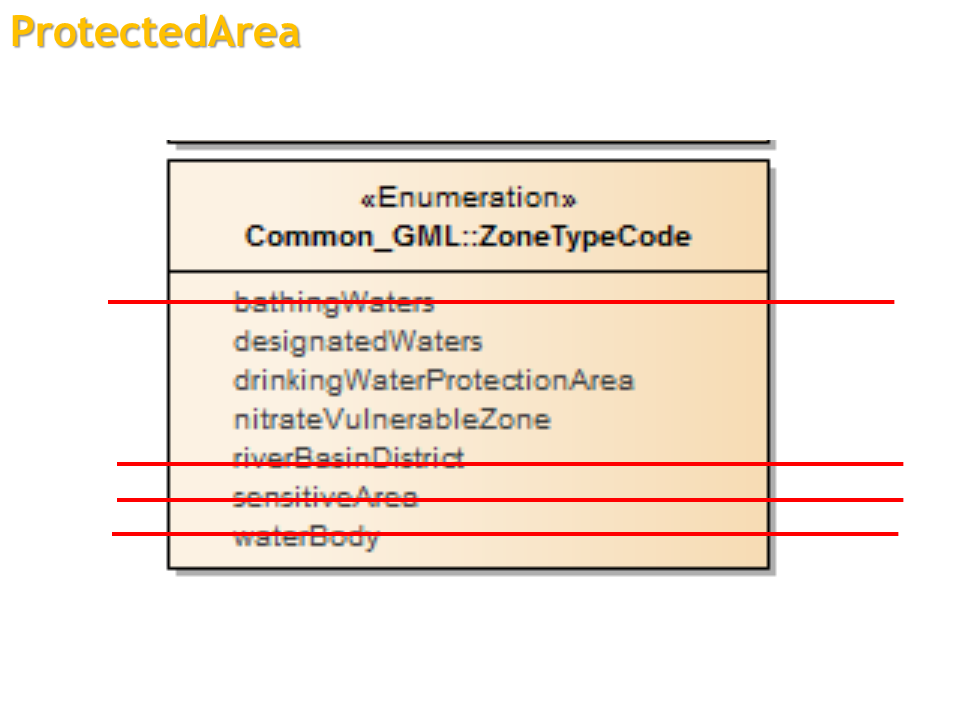
- 5. PROTECTED AREAS (SCHEMAS SWB AND GWB)
- 6. REPORTING AT MS LEVEL: COMPETENT AUTHORITIES, RBDS AND SUB-UNITS (SCHEMA RBDSUCA)
- 7. REPORTING AT RBD/SUB-UNIT LEVEL FOR SURFACE WATER (SCHEMA SWMET)
- 7.3. Methodologies classification ecological status and potential
- 7.4. Methodologies classification chemical status
- 7.5. Overall management objectives (nutrients, river continuity)
- 7.6. Definition of significant pressures and impacts
- 7.7. Methodologies exemptions
- 8. REPORTING AT RBD/SUB-UNIT LEVEL FOR GROUNDWATER (SCHEMA GWMET)
- 8.4. Definition of significant pressures and impacts
- 8.5. Methodologies exemptions
- 9. REPORTING AT RBD/SUB-UNIT LEVEL FOR RBMP (SCHEMA RBMPPOM)
- 9.4. Water abstractions and exploitation of water resources
- 10. PROGRAMME OF MEASURES REPORTED AT RBD/SUB-UNIT LEVEL (SCHEMA RBMPPOM)
- 10.2. Targeted questions on basic measures and other aspects
- 10.3. Estimates of cost of measures
- 10.4. Co-ordination of measures in international RBDs
- 10.5. Progress with and achievements of the programme of measures for the first planning cycle
- 11. REPORTING AT RBD/SUB-UNIT LEVEL FOR ECONOMIC ANALYSIS AND COST RECOVERY (SCHEMA RBMPPOM)
- Overview of comments presented at WG DIS
- WISE spatial data presentation at WG DIS
WISE spatial data presentation at WG DIS
Slide 1
Slide 2
Slide 4
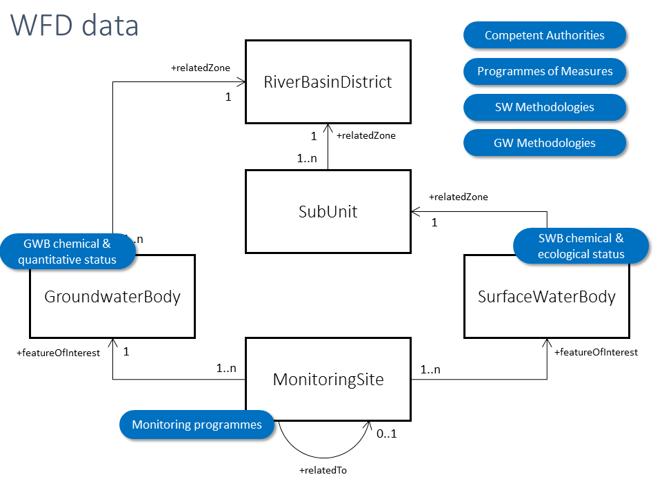
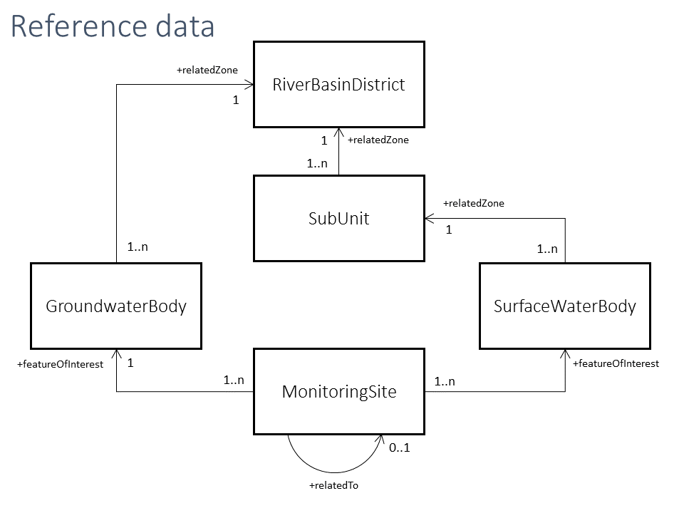
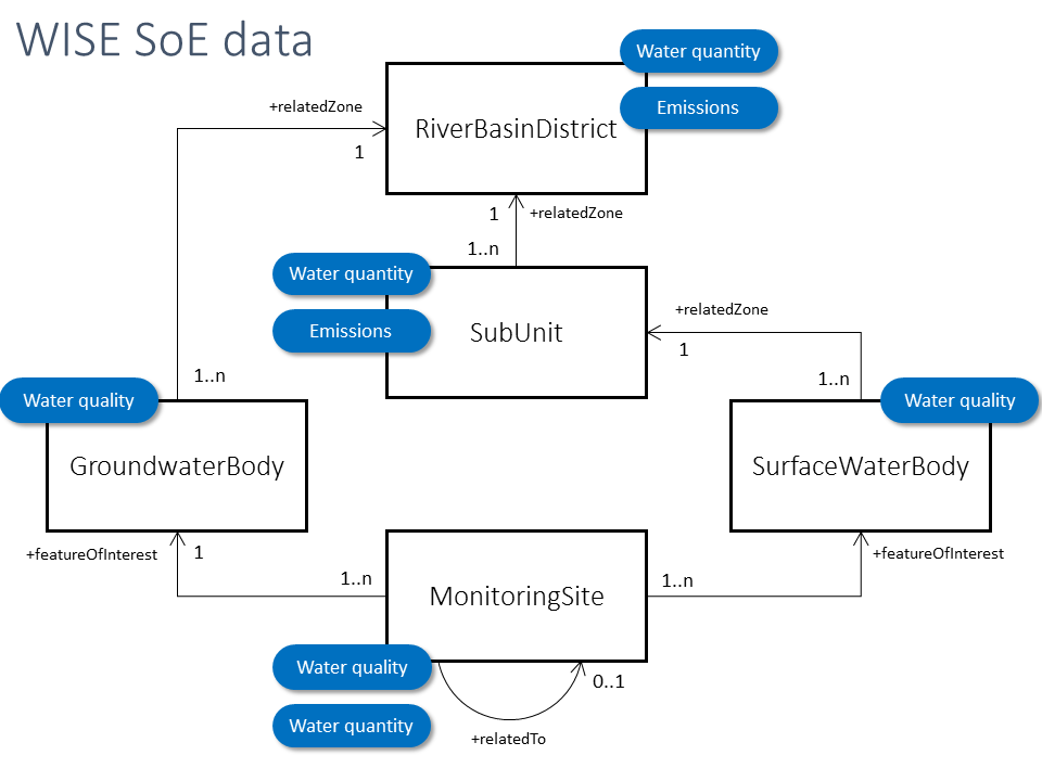
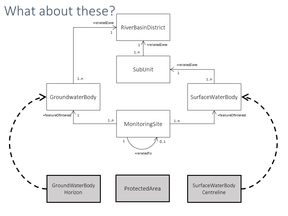
Reference data sets
The 5 datasets are needed and used.
- Can the RiverBasinDistrict dataset
be derived from the SubUnit dataset? - Can an agreement be reached
on the inclusion/exclusion of
coastal waters and territorial waters? - Are all attributes needed (and reported)?
Slide 6
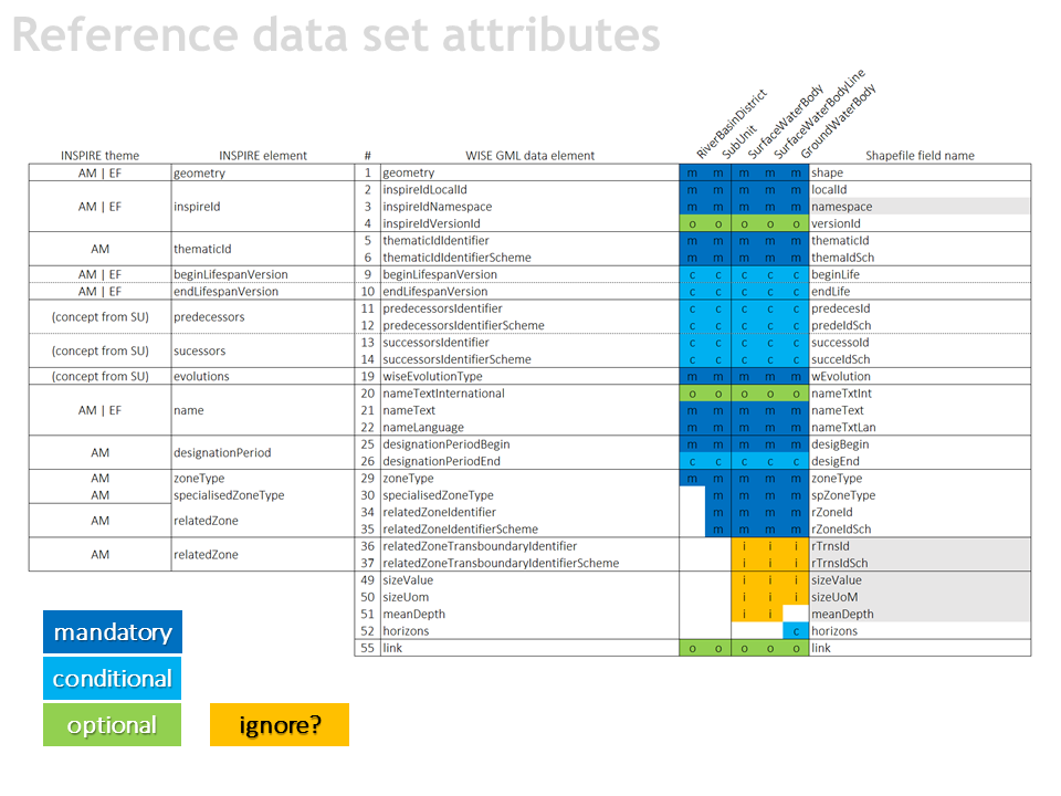
Should this information be reported in 2022?
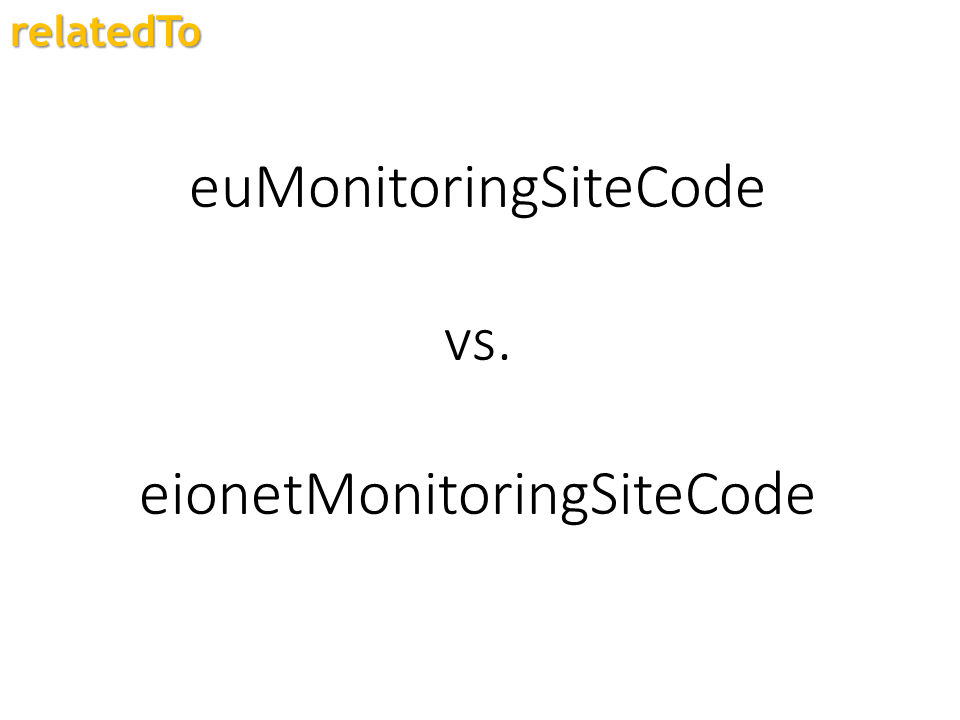
- relatedZoneTransboundaryIdentifier
reported in only 0.3% of the water bodies - sizeValue
values had to be
calculated from the geometry - meanDepth
only 6.4% of the lakes
Slide 8
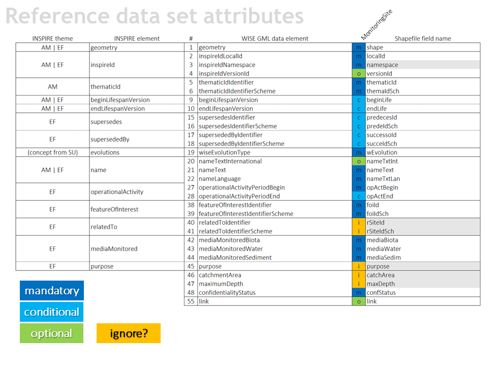
Should this information be reported in 2022?
- relatedToIdentifier
reported in only 0.7% of the sites - purpose
duplicate with relation
to the descriptive data in the XML - catchmentArea
only 33% of the sites on rivers - maximumDepth
only 22% of the sites
Slide 11
SurfaceWaterBodyCentreline
- Currently it is optional
- Could it be reported
for lakes and reservoirs?