
Navigation
Post a comment on the text below
Slide 8
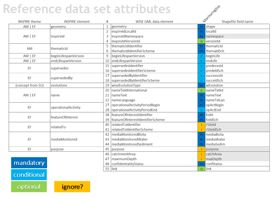
Should this information be reported in 2022?
- relatedToIdentifier
reported in only 0.7% of the sites - purpose
duplicate with relation
to the descriptive data in the XML - catchmentArea
only 33% of the sites on rivers - maximumDepth
only 22% of the sites
You cannot post comments to this consultation because you are not authenticated. Please log in.
Previous comments
Spatial Data Schemas.
Spatial data schemas should be simplified. Approach depicted in slide 6 and 8 is far more optimal than the current one. Using the nomenclature from INSPIRE schemas would make it a lot easier to map data sets in ETL tools for INSIRE. WaterBodies, RBD’s, SU’s should have AM theme elements as its core. MonitoringStations should have EF theme elements as its core.
duplicate with relation to the descriptive data in the XML
We are of the opinion that the information is not necessary, because this is in XML.
only 33% of the sites on rivers
We are of the opinion that the information is not necessary.
only 22% of the sites
We are of the opinion that the information is not necessary.
Regarding the question "Should this information be reported in 2022?":