
Navigation
Post a comment on the text below
Slide 6
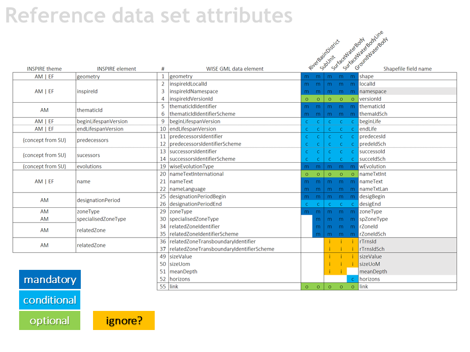
Should this information be reported in 2022?
- relatedZoneTransboundaryIdentifier
reported in only 0.3% of the water bodies - sizeValue
values had to be
calculated from the geometry - meanDepth
only 6.4% of the lakes
You cannot post comments to this consultation because you are not authenticated. Please log in.
Previous comments
Transboundary identifies are very difficult to maintain. The depth of the lakes is available only for a few lakes.
The suggested changes are agreed.
Slide 6-8
relatedZoneTransboundaryIdentifier, sizeValue, meanDepth, relatedToIdentifier, catchmentArea, maximumDepth – those attributes should be removed from schema. PL will not provide them in 2022 reporting and looking back on the 2016 reporting, this might be the case for many o other MS.
purpose – duplicates should be avoided whenever it is possible. It is far more difficult to provide proper data quality when you need to keep track in how many places to update/correction is needed. This may lead to inconsistency of database and thus decrease its overall credibility.
values had to be calculated from the geometry
We disagree with "sizeValue" to be calculated from the geometry. The sizeValue have to be calculated in projected coordinate system of each country.
only 6.4% of the lakes
We are of the opinion that the information is not necessary. We don't have available the meanDepth for the water bodies.
Regarding the question "Should this information be reported in 2022?„ we do not oppose to the deletion of GML data elements "relatedZoneTransboundaryIdentifier, sizeValue, meanDepth".